Sussex County photographers Pam Aquilani and Tony Pratt take Coastal Style along on their not-so-leisurely tour of the West Coast, covering 1,300 miles in 10 days
Written by Tony Pratt
We humans are fundamentally programmed to travel and explore. How else would our ancestors have walked, sailed, rode or flown to virtually every square foot of the Earth? No other species can claim that unique wanderlust. When I met Pam several years ago, I learned she had very little travel experience beyond the East Coast. As our friendship turned into a committed relationship, we talked increasingly about traveling and taking photographs, as two avid photographers often do. Plans were made, tickets were bought, reservations were secured (Pam’s genius here), and her first visit to the West Coast became a reality in the summer of 2019. I’ve been to the West Coast many times, so I was the itinerary planner, a guide if you will, for my newcomer traveling companion. Actually, make that companions, as Pam’s 15-year-old daughter, Sarah, was adamant that she not be left out of this adventure. What Pam and Sarah did not know was that I packed an engagement ring, hidden away in a rolled up pair of socks, deep in my duffel, just in case the right spot and moment collided. So, the adventure started with a flight from Philadelphia to Portland, Oregon. With the wonders of jet travel from east to west, we enjoyed a very early breakfast in the Philly airport and midmorning coffee and doughnuts in Portland. So begins the fun.
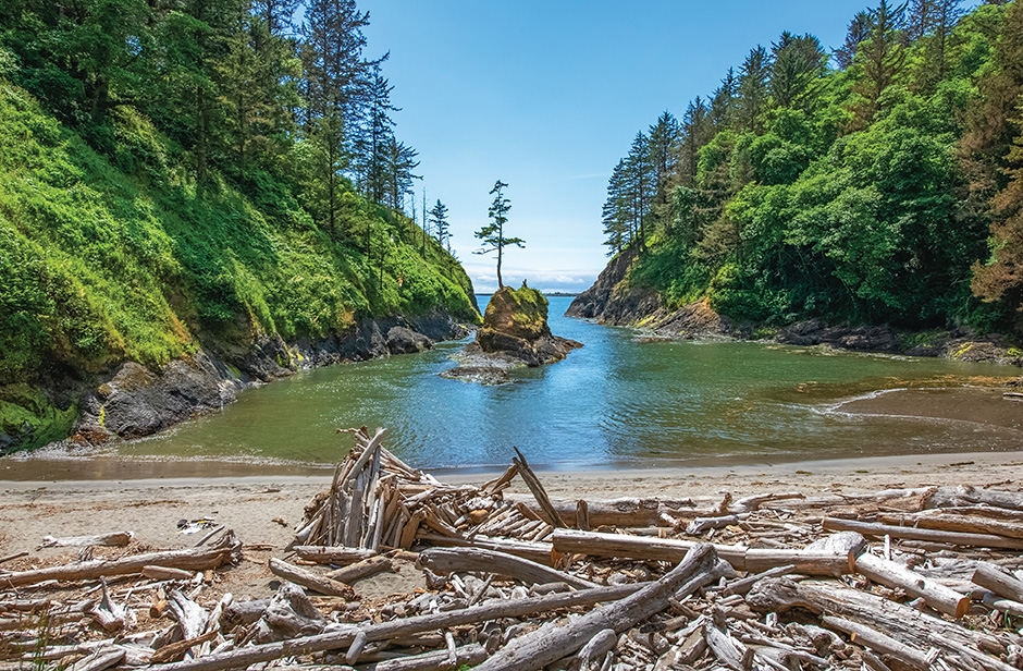
The first stop on our first day in our rental car was across the Columbia River into Washington State. We just couldn’t be this close and not be able to say we had been in Washington. On that side of the Columbia River entrance to the Pacific, there is a very cool place named Cape Disappointment State Park. We had done our homework prior to the trip.We scoured online resources, maps, travel-advice blogs and anything else we could find that gave us insight into the kind of places we wanted to experience and photograph. This shot of Cape Disappointment captures a truly unique, out-of-the-way spot that requires a bit of a hike to get to. This is the cove that enters the mouth of the Columbia River.
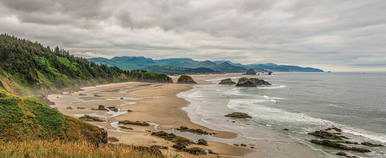
The next day, the first full day of exploring, began with an early-morning drive to Ecola State Park, in Oregon. I am a map guy (it dates to my road trips in the ’70s), so I had my trusty AAA map of Oregon open on the car’s front seat, with spots Pam and I had researched and circled back in Lewes. Ecola State Park offers an undeveloped nine-mile stretch of coastline in between the two beach towns of Oceanside and Cannon Beach. We stopped at this overlook to enjoy the typical gray, misty, coastal-Oregon morning weather and had a serendipitous conversation with a park ranger. He told us we were very fortunate to be there that morning, as the tide was exceptionally low and it was about the best day of the year to view the tide pools. Off we went toward the car, and, almost as an afterthought, he advised us: “But be very careful; when the tide begins to flood back in, it will come in very fast.”
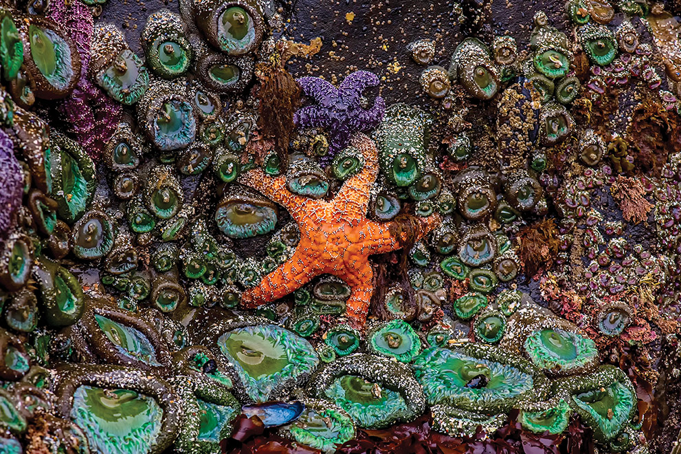
The tide pools at Ecola are incredible — and we were indeed very lucky to have such an exceptionally low tide. Every square inch of the rocks in the intertidal zone was covered with one form or another of sea life. The sea stars and anemones were other-worldly. Their spectacular colors and abundance are a photographer’s dream come true.
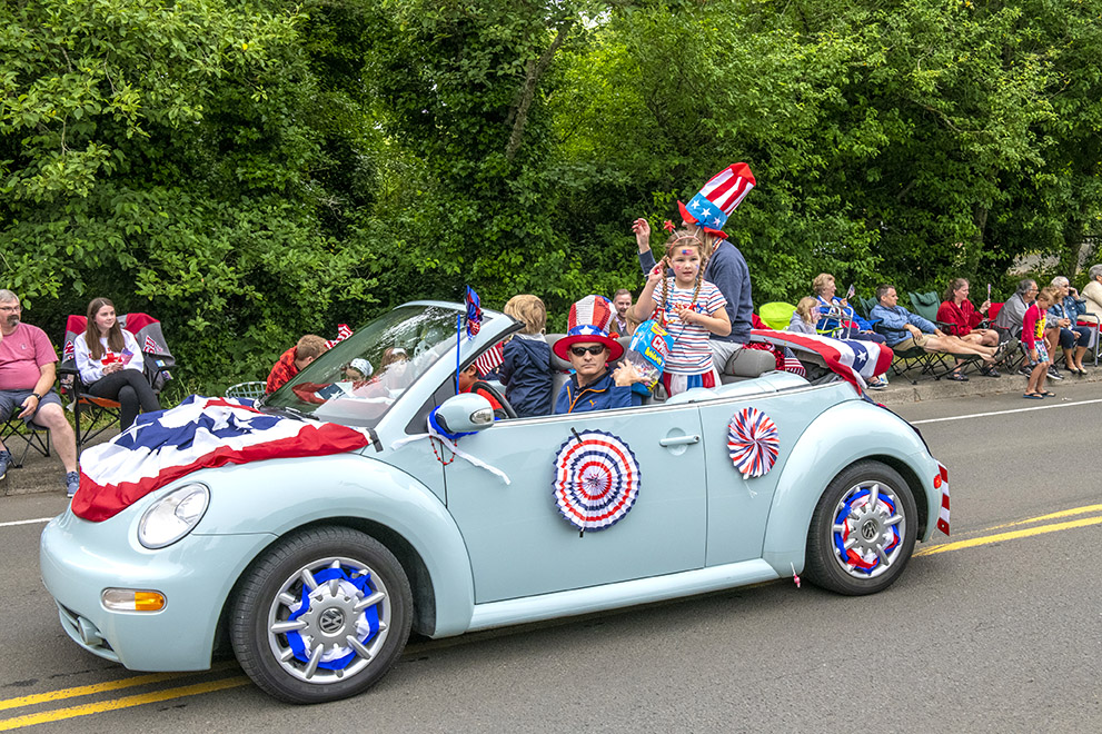
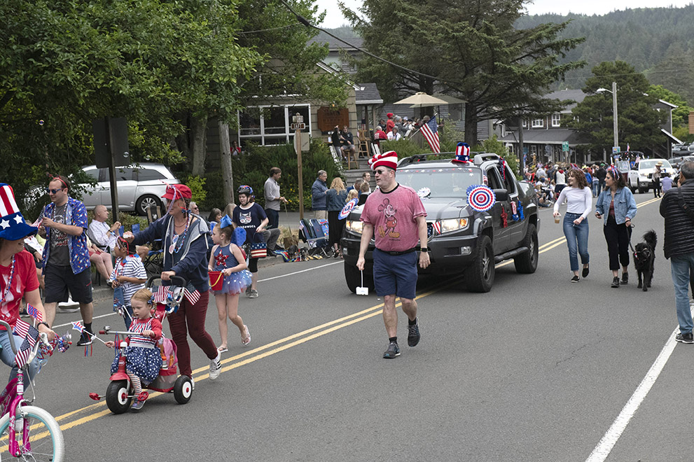
We hadn’t completely forgotten that our first full day was also the 4th of July. Leaving Ecola, we drove into Cannon Beach and were lucky enough to find a table at a popular downtown restaurant for breakfast. Lucky, because the Independence Day parade in Cannon Beach was just getting underway and we could watch most of it as we enjoyed eggs and pancakes. We were back on the street for the end of the parade and loved the free-spirited nature of their homegrown ‘doo-dah’ parade.
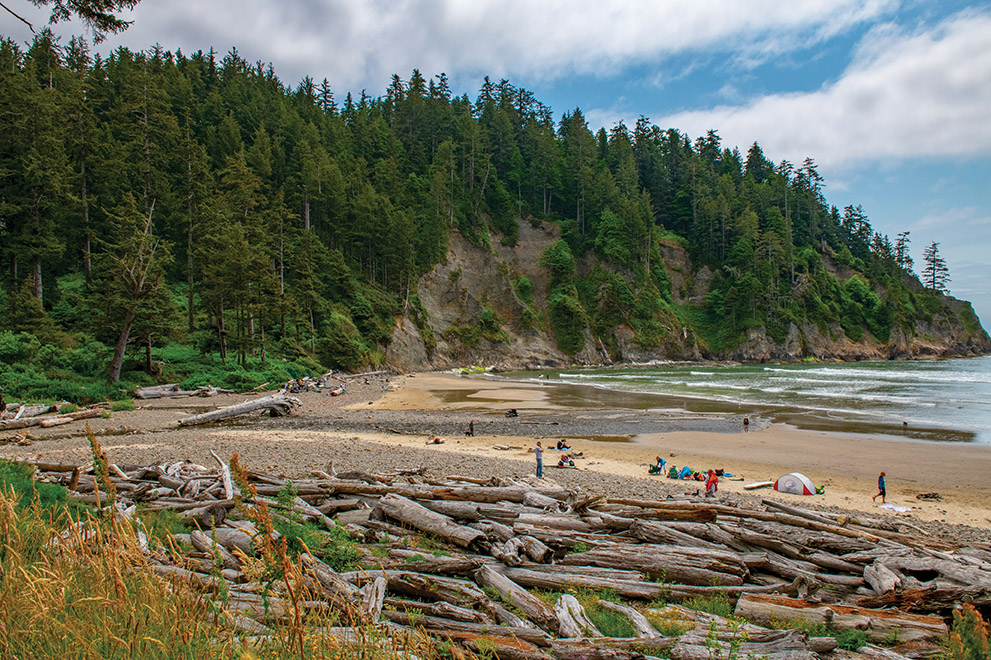
Our basic travel plan was to stick to the closest main road paralleling the coast as we headed south toward California, which through much of Oregon is Rte. 101. From Cannon Beach down 101, a short nine miles, is a beautiful spot with a forbidding-sounding cove. Starting from a roadside pull-off at Oswald West State Park, we hiked through an old-growth forest of hemlocks, downhill to the beach at Smuggler Cove. This is a popular surfing spot, with whole-tree driftwood strewn about the upper beach because of strong winter storms that come out of the Gulf of Alaska. Drift logs such as these are common along the Oregon coast, and we saw them at nearly every beach we visited. Surfers had set up tents for their stays. The beaches we saw in Oregon were never crowded, and people often set up tents for stay-overs right on the beach.
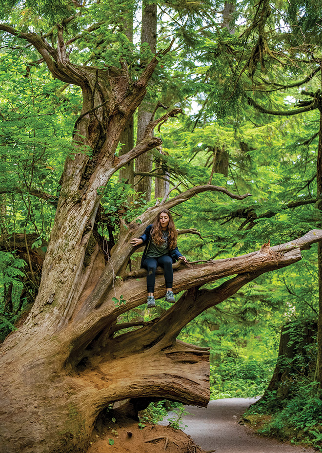
The hiking path through Oswald West passed through a deep forest of old-growth trees. We asked Sarah to climb up a fallen tree — the roots of which had to be cut to open the trail — to provide scale. The immensity of this tree is readily seen with her perched on an old root.
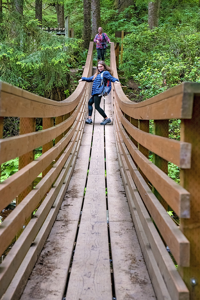
Oregon State Park crews really do a great job with trails and access to their natural assets. Here, a foot bridge crosses a creek just up from the beach at Oswald West.
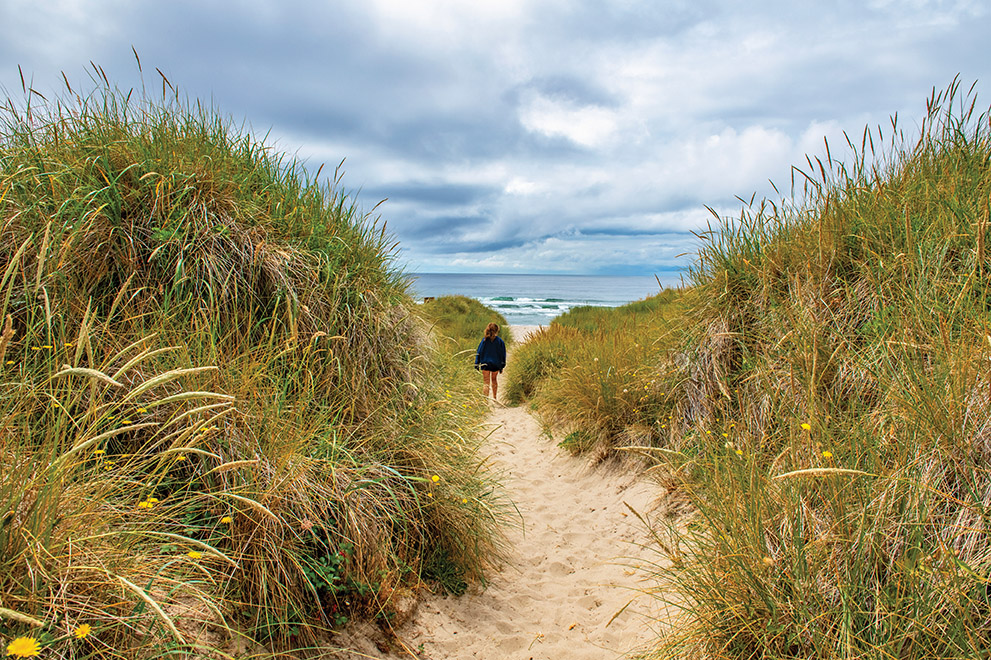
Yes, there are beaches and dunes in Oregon, much like the beaches here on Delmarva. It’s not all cliffs and rocks and tide pools, although that variety of coast was really enjoyed by us. As we make our way across sand dunes and beach, Sarah is leading the way, as usual, to the ocean at Nehalem Bay State Park.
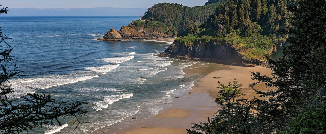
From Astoria, where we stayed for the first two nights, we traveled south on Rte. 101 and stayed with friends in Waldport, then set out south again. The Heceta Head Lighthouse, which is between Yachats and Florence, is a must-stop-and-photograph subject. There is a strategically placed pull-off on 101 where probably most travelers stop for the shot. As we traveled south, the weather was decidedly better, much more sunshine and fewer low-ceiling gray clouds. The lighthouse was built in 1892-93 and now includes a B&B. The lighthouse was automated in 1963, which eliminated the need for a lighthouse keeper; the keepers’ house became the B&B.
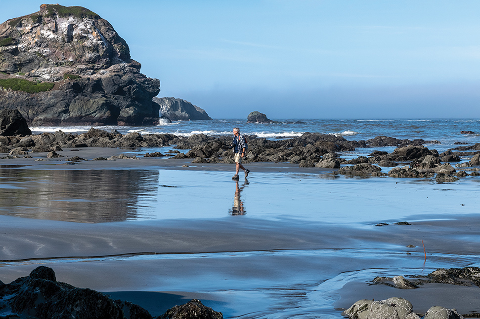
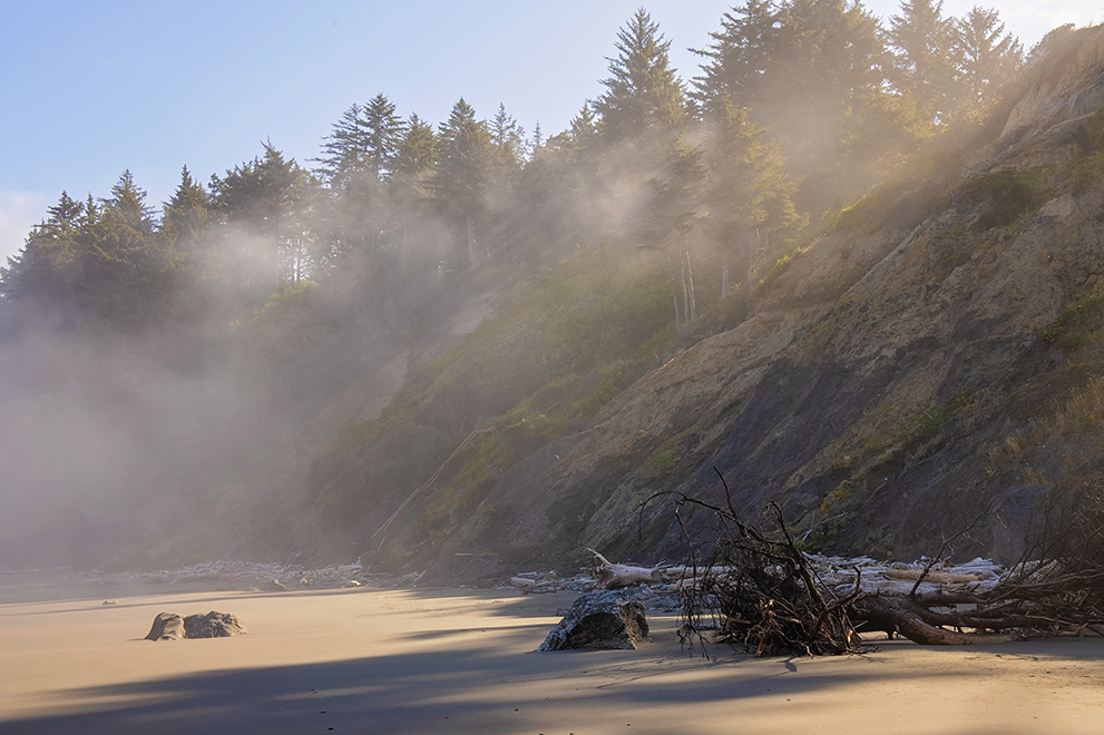
We stayed at The Windsong Garden Cottage Airbnb in Gold Beach, where the owners were in residence next to our cottage. They are very friendly folks, and we had a nice time touring their beautiful gardens. They asked if we knew the area well (which we did not) and urged us to visit the beach at Otter Point State Recreation Area. What a find! We were a little wary as we looked at the rope that was attached to the side of the steep hillside/cliff that led from the parking area down to the beach, but we managed to lower ourselves down with all our gear just as the mist was clearing from the beach. The tide was low, which gave us a very wide area to explore across sand flats and among the rocks.
Looking up the beach from the stretch I was walking on in the previous photograph, we caught early light filtering through the trees on the top of the bluff. We had hoped for this photo opportunity, early-morning sunrays streaking through the trees as we found this pot of gold at Gold’s beach.
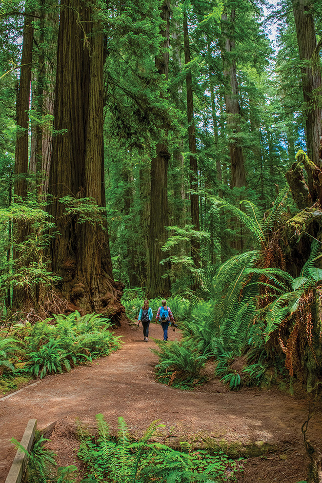
We crossed into California five days after we landed in Portland and three days after we left Astoria. Just outside of Crescent City is Jedediah Smith Redwoods State Park, a 10,430-acre redwood preserve with many old-growth trees. Without scale to judge their size, these trees might not be so impressive, but here Pam and Sarah are dwarfed by these long-lived giants. This is on the Simpson-Reed Trail off Rte. 199.
Photo by Sarah Bieler
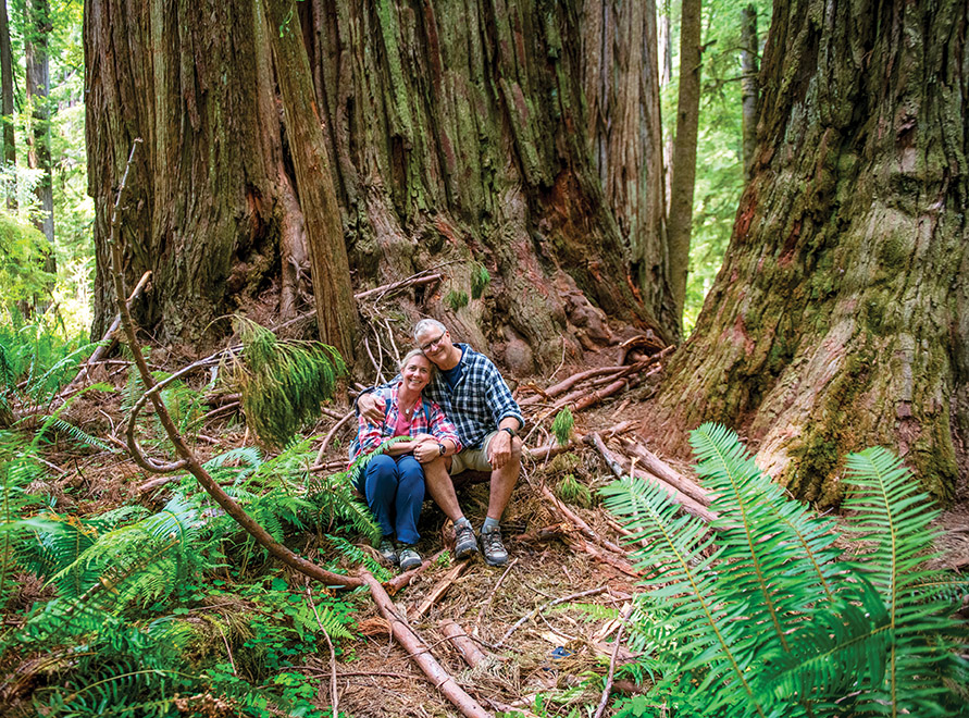
Remember that engagement ring I’d stashed away in my rolled-up socks back in Delaware? I had envisioned the redwood forest as a very likely place to pop the question. So, early that morning, in Gold Beach, I hid the ring in my backpack, just in case the right moment arrived. It did. In a grove of huge redwoods, I asked Pam to sit down then fumbled around in my pack for a moment to set up my GoPro to record the event. Sarah did not know I was going to propose, but she intuitively knew something important was going down, and she recorded it too. She also took our picture right after Pam, thankfully, said yes.
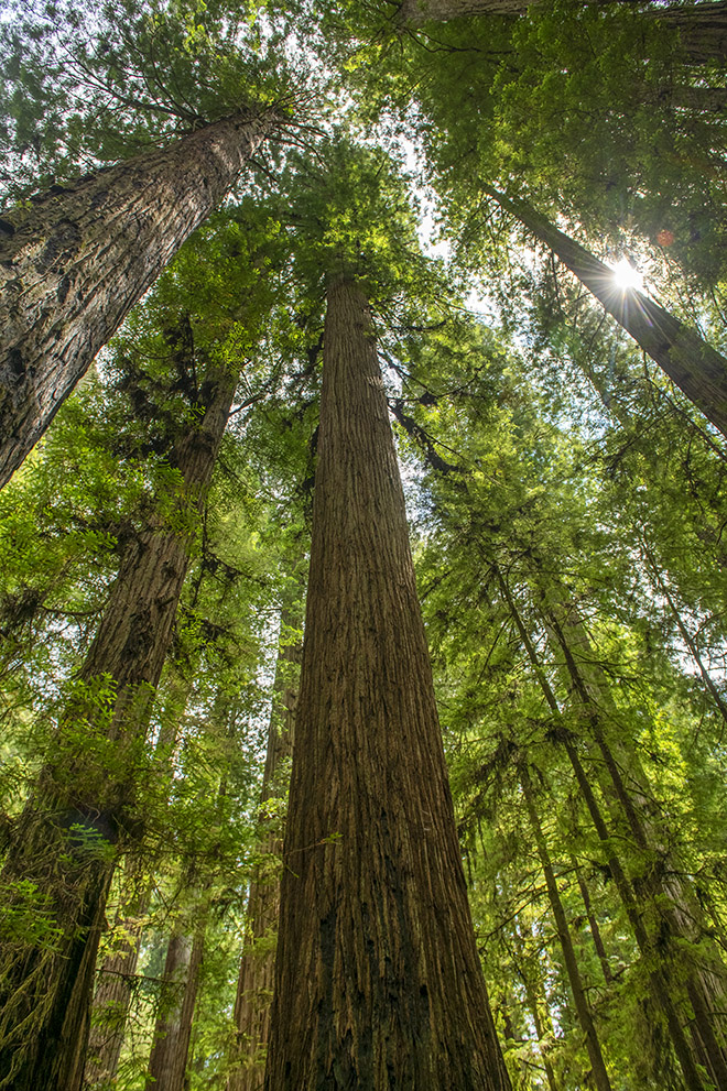
If you’ve ever stood on the forest floor and looked straight up at the canopy above in the redwoods, you will recognize this sight. The tops of some of these trees are about as high as a 30-story building and as much 2,000 years old. We will, without a doubt, go back here.
We stayed the night near the Smith River, outside of Crescent City, then drove through redwoods and along the California coast to Mendocino, where we had booked a small cottage for two nights. Pam and I woke up early and headed north on CA 1, to Jug Handle State Natural Reserve. The reserve has very interesting geologic features and an equally interesting history about how it came to be protected from development. I just loved the beauty of the area and the photography possibilities. Pam and I enjoyed nearly two hours of exploring and shooting and could have stayed all day. But, Sarah was back at the cottage, and we had a lot more to see and do around Mendocino.
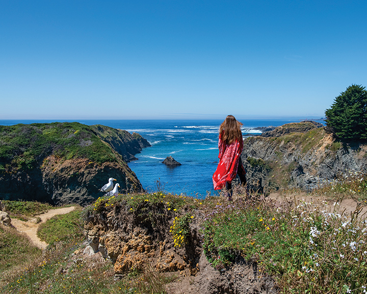
Between Mendocino’s homes and shops and the ocean lies a very large area of open land, with streets that lead right up to the ocean’s edge. Looking out over Goat Island and the Pacific, Sarah and her gull friends have an apparently bonding Zen moment. Mendocino is a small, unincorporated community of a little over 800 residents. It is well known for its summer music festival and spectacular coastal landscape. Our drive south from Mendocino took us along the Navarro River, through a thick, coastal redwood forest, where Pacific-born rain keeps the land very wet, on into the much drier wine country of the Anderson Valley.
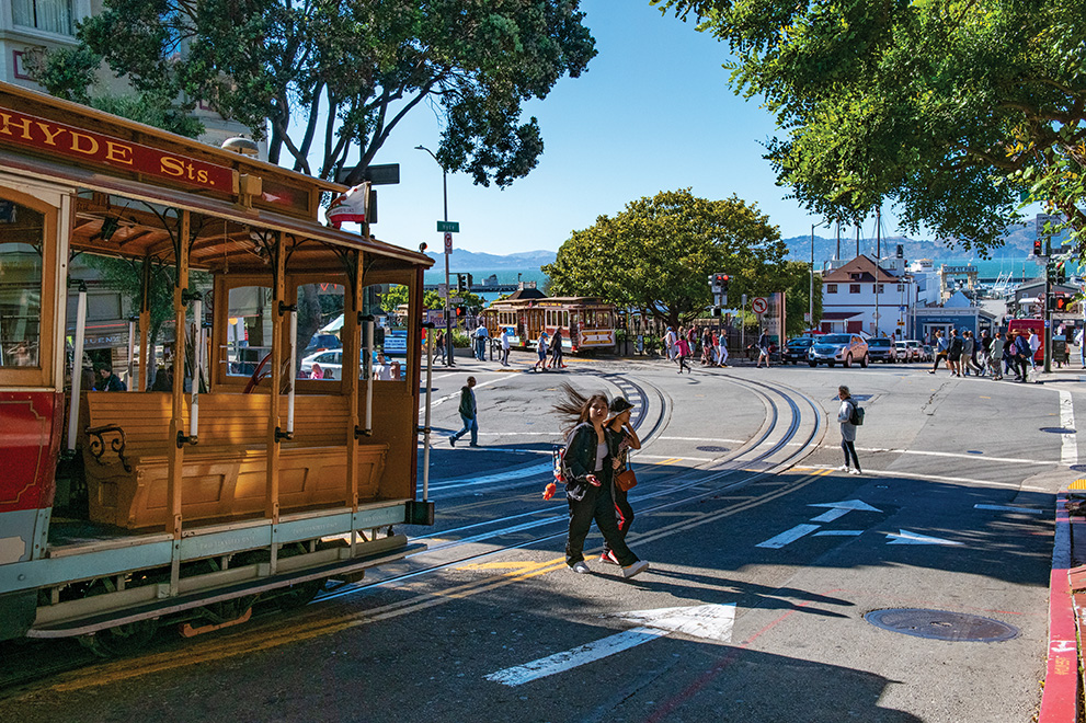
Our whirlwind trip ended with a flight back east, out of San Francisco. We booked a red-eye flight and arrived in town the day before the flight, which gave us about 27 hours to sightsee in the City by the Bay. This photograph is taken near The Hyde Street terminus of the cable car that runs from Powell Street to Hyde near Fisherman’s Wharf. The bay and Marin Headlands across the Golden Gate are seen in the background.
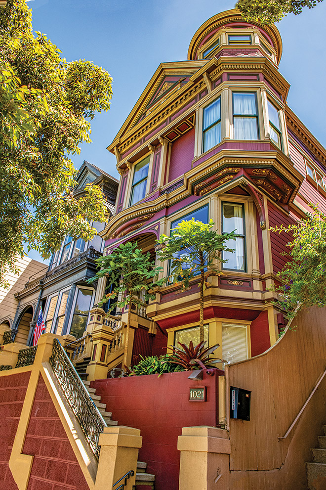
There is a vast array of architectural styles throughout San Francisco. It truly is a city with stunning buildings and inspired style. Just around the corner from the famous Painted Ladies — shown at the beginning of every episode of the TV show Full House — is a row of beautiful Victorian-style homes. This a great example of the splendor of these buildings. Boy, did we ever want to be invited inside for a tour, but no luck there. The whole area surrounding Alamo Square Park, where this photograph was taken, is recommended for exploration.
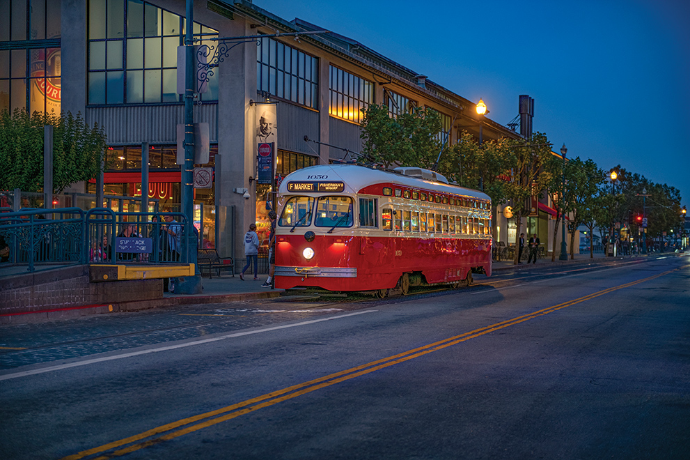
Our last full night on the West Coast included a little night photography. This is an electric trolley bus. San Francisco’s Muni transport system utilizes electric “heritage” trolleys, streetcars and buses, which add a stylish atmosphere to the streets. Bus 1050 (shown here), which was originally owned by the Philadelphia Transportation Company but later sold to Muni, has been serving San Francisco since the early 1990s. It was fitting that one of the last evening sights in San Francisco was a bus that originated in Philadelphia. The next afternoon, we drove to the airport for our plane ride back to Philly. CS
One Response
What a lovely trip to have photographed and be engaged! I enjoyed every beach and always wanted to do this highway coast trip too. Thank you for including us in your Wild, Wild, West adventure. I live in the Delmarva area and picked up the Jan/Feb 2022 issue of Coastal Style. When’s the wedding? 😉💐❤️🍾🎊
What a lovely trip to have photographed and be engaged! I enjoyed every beach and always wanted to do this highway coast trip too. Thank you for including us in your Wild, Wild, West adventure. I live in the Delmarva area and picked up the Jan/Feb 2022 issue of Coastal Style. When’s the wedding? 😉💐❤️🍾🎊